
Satellite IoT and Smart Logistics: How Real-Time Tracking Is Reshaping Supply Chains
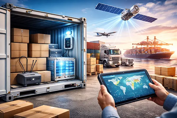
Supply chains in 2025 look very different from just a few years ago. The biggest shift is not only better analytics or faster warehouses, but the ability to stay connected to assets anywhere on Earth. Satellite IoT has moved from a niche tool used mainly in maritime and remote industries to a practical layer of logistics visibility. When vehicles, containers, pallets, and even individual high-value items can report their location and condition beyond mobile coverage, planning becomes more precise, risk reduces, and disruptions become easier to manage.
Why satellite IoT has become a practical tool for logistics in 2025
Traditional tracking depends heavily on terrestrial networks: 2G/4G/5G, Wi-Fi, or local gateways. The weakness is obvious—coverage gaps are common in oceans, deserts, mountains, rail corridors, and even some rural road networks. Satellite IoT fills those gaps, which is why logistics and transportation are expected to be one of the largest adopters of upcoming 3GPP Non-Terrestrial Network (NTN) IoT connectivity. According to IoT Analytics, the number of satellite IoT connections reached about 7.5 million in 2024, and the market is forecast to grow strongly through 2030, driven by demand for dependable global visibility. :contentReference[oaicite:0]{index=0}
Another reason satellite IoT is now more accessible is standards-based connectivity. With 3GPP Release 17 NTN, IoT devices can connect to satellites using cellular-derived technologies like NB-IoT in ways that are closer to what telecom engineers already know. Industry guides from GSMA highlight that NTN capability allows certain cellular technologies to connect directly to satellites, reducing the need for specialised satellite-only hardware in many use cases. :contentReference[oaicite:1]{index=1} This matters for logistics because it lowers integration barriers and speeds up deployment across fleets and asset types.
Finally, the business model has matured. Instead of choosing between “cellular only” or “satellite only”, more companies now deploy hybrid connectivity: devices use terrestrial networks when available and fall back to satellite when they are out of range. A concrete 2025 example is Tele2 IoT launching satellite IoT connectivity with Skylo, describing automatic switching between terrestrial and satellite networks for sectors including logistics. :contentReference[oaicite:2]{index=2}
What “real-time” tracking actually means with satellite IoT
It is important to be precise with terminology. “Real-time” in logistics usually means operationally real-time: updates frequent enough to support decisions while the shipment is still in motion. Satellite IoT can provide anything from near-continuous tracking (when power and airtime budgets allow) to periodic health checks every 15–60 minutes. The best configuration depends on cargo value, risk profile, and how quickly a decision needs to be made.
For example, a refrigerated container of pharmaceuticals may need frequent temperature and door-status updates, because a short excursion can ruin the load. A bulk commodity shipment might only need location pings a few times per day. Satellite IoT enables both patterns: it extends monitoring beyond mobile coverage, and it also makes it possible to keep the same sensor logic across routes rather than redesigning tracking around network availability.
Latency is another factor. Some satellite IoT services are designed for small, low-power messaging and can be highly efficient for basic telemetry, while higher-bandwidth services support more complex data. Iridium Certus 100, for instance, is positioned for smaller, lower-power applications and supports IP data speeds up to 88 Kbps, which can fit real-time asset management and monitoring scenarios where modest data throughput is enough. :contentReference[oaicite:3]{index=3}
How real-time visibility changes planning, inventory, and risk management
When a company can see where assets are and what condition they are in—even outside mobile coverage—planning becomes less dependent on assumptions. Real-time visibility reduces the “blind time” between scan events, which historically forced logistics teams to build buffers into every schedule. In practice, satellite IoT supports more accurate Estimated Time of Arrival (ETA) models, better dock scheduling, and improved allocation of labour and equipment at distribution hubs.
Inventory management also shifts. Companies often hold extra stock because the true position of goods in transit is uncertain. If a shipment is delayed in a remote corridor, teams find out too late and compensate by keeping higher safety stock. With satellite IoT tracking, planners can respond earlier—rerouting, rebooking, or reallocating inventory before service levels are affected. Over time, that can reduce working capital tied up in “just in case” inventory.
Risk management becomes more proactive. Real-time tracking helps detect theft, tampering, unplanned stops, or route deviations—especially relevant for high-value cargo and sensitive supply chains. In maritime logistics, satellite connectivity is also linked with safety and compliance improvements, as operators can keep vessels tracked and connected more consistently. Recent maritime tracking developments have included operational support for Iridium Certus in commercial tracking solutions, highlighting how satellite connectivity is increasingly integrated into compliance and security workflows. :contentReference[oaicite:4]{index=4}
Condition monitoring: temperature, humidity, shock, and door events
Location is only part of the story. In 2025, smart logistics increasingly relies on condition monitoring, because damage and spoilage costs are often higher than simple delays. Satellite IoT supports sensors that track temperature, humidity, vibration/shock, tilt, light exposure, and door open/close events. For cold chain operations, this is the difference between “we delivered late” and “we delivered unusable goods”.
The practical benefit is traceability with fewer gaps. If a refrigerated trailer loses cooling power in an area without terrestrial coverage, a satellite-connected sensor can still report the event. That gives teams the chance to intervene—changing driver instructions, diverting to a service point, or transferring cargo. The same applies to shock events in fragile goods: if a container experiences high-impact movement, the supply chain can flag the shipment for inspection before it reaches the final customer.
There is also a compliance angle. Many industries must prove that goods stayed within certain conditions during transit. A reliable sensor record that continues through remote stretches makes audit trails stronger and reduces disputes. It is not only about technology; it is about reducing uncertainty in customer claims, insurance negotiations, and quality assurance processes.
Implementation in the real world: networks, devices, and operational pitfalls
Deploying satellite IoT is not just a connectivity decision; it is an operational design project. Companies need to choose between messaging-oriented satellite IoT, higher-bandwidth satellite services, or NTN-based approaches that align with cellular standards. In practice, large logistics organisations often end up with a tiered approach: low-power satellite messaging for containers and pallets, and higher-throughput links for vehicles, vessels, or remote depots that need richer telemetry.
Hybrid connectivity is typically the most cost-effective approach. Devices use cellular networks when available and automatically switch to satellite when coverage drops. The 2025 Tele2 IoT and Skylo launch is a relevant example of this model, describing seamless switching so devices stay online in areas beyond terrestrial reach, including logistics environments. :contentReference[oaicite:5]{index=5} This reduces airtime costs and helps preserve battery life while still maintaining continuity.
There are also market realities to consider. Some legacy satellite IoT options are being phased out. Swarm Technologies, for instance, had a store-and-forward satellite IoT network, but commercial service ended in March 2025. :contentReference[oaicite:6]{index=6} For logistics teams, this underlines the importance of vendor due diligence, roadmap clarity, and contract planning before choosing hardware that might depend on a sunset network.
Best practices for getting measurable value (not just more data)
Start with a clear use case and measurable KPIs. Satellite IoT can generate a lot of telemetry, but value comes from decisions: fewer lost assets, reduced spoilage, fewer delays, better utilisation of fleet capacity, and tighter compliance. Before deploying at scale, teams should define what counts as success—such as reducing cold-chain excursions by a target percentage or cutting the average time to detect route deviations.
Design the data flow as carefully as the device. Many failures come from “data in a dashboard” with no operational ownership. Alerts should be connected to playbooks: who is notified, what actions are allowed, how escalation works, and how exceptions are documented. If the organisation cannot act on the information, the tracking system becomes noise.
Finally, balance update frequency with power and costs. “More frequent pings” is not automatically better. For some shipments, a location update every 10 minutes is essential; for others it adds cost without improving outcomes. The smartest deployments define different profiles based on cargo value, risk, and route characteristics. In 2025, that is where satellite IoT and smart logistics become genuinely transformative: not because they collect data everywhere, but because they enable consistent decision-making everywhere.